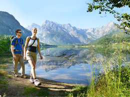
ENJOYMENT ALONG THE ALM-RIVER - 52 kilometres of hiking from the "Almspitz" to the lake Almsee


4645 Grünau im Almtal

Riverside delights - “Genuss am Almfluss” is a walking tour through the Almtal valley
Bad Wimsbach-Neydharting
Starting at the Almspitz near Bad Wimsbach-Neydharting (still in the municipality of Fischlham), turn left coming from Edt bei Lambach after the bridge and immediately left again to get to the Alm, walk along the Alm to the first bridge (pedestrian), then follow the side road to the Almeggbrücke bridge.
From there you have the possibility to get to the center of Bad Wimsbach-Neydharting , where you will also find the entry point at the station of the Vorchdorferbahn with parking. The Genuss am Almfluss partner businesses Mostschenke Huemer and Gasthof Dickinger as well as the two museums Freilichtmuseum Hackenschmiede and the new Early History Museum are also located here.
From the Almeggbrücke bridge, you walk along the Alm through the beautiful alluvial forest to the mouth of the Laudach.
The next train stop is only about 500 meters away (AU stop).
Here you have to follow the course of the Laudach a little to the bridge, cross it and then follow the river again to the Alm and back to Vorchdorf.
Vorchdorf
Pass the district of Haresau and continue upstream along the Alm until you reach the gravel works. Follow the access road for a short distance until just before the Mühltal highway bridge, where the path leads up the slope to the right. (Go through a pedestrian and cycle underpass under the highway, past a nice housing estate to the road. Cross the road (please take care) and follow the signs through the forest. After approx. 500 meters turn right until you come out at the Vorchdorf sports field. Stay on this side of the road and cross the road at the crosswalk next to the traffic circle and then turn left towards the church and you are at the Schlossplatz in Vorchdorf. The Genuss am Almfluss partner business Hoftaverne Ziegelböck is only a 2-minute walk away.
Cross the Schlossplatz in the direction of the Laudach bridge and turn left after the bridge and follow the path along the Laudach. Shortly after the outdoor pool, cross the footbridge over the Laudach. From here you can also reach the Vorchdorf-Eggenberg train station in just 2 minutes, where you have connections to the Stern & Hafferl train lines to Lambach and Gmunden. There are also plenty of parking spaces in Vorchdorf (e.g. Schwarzlmüller parking lot directly at the Laudach bridge after the Schlossplatz).
After the footbridge on the right you reach the Vorchdorf rest area. Enjoy the moment and take a seat in one of the wooden spoons. Then continue along the Laudach, cross the road and follow the path to the Schloss Eggenberg brewery, the next partner company of Genuss am Almfluss. Before the brewery, turn left, right next to the entrance up the hill. Follow the path in the direction of Pappelleiten/Einsiedling. Shortly before Pappelleiten, cross the road again and head down towards Alm. Following the path, you come to the road after a nice stretch along the alpine pasture. There is a parking lot directly opposite, which you could also use for a stage hike. Follow the road briefly, then turn left over the bridge to Eggenstein, a district of Pettenbach.
Pettenbach
After the bridge, turn left along the alpine pasture for a good distance until you reach the Kronawettwehr power station, a partner company of Genuss am Almfluss. Right next to it is the Pettenbach massage rest area, which you can use to relax and pamper yourself. A special parking lot has also been created here so that you can visit the show power station and the active rest area directly.
Note on the connecting path from the center of Pettenbach to Almburg, which is also dotted on the Genuss am Almfluss map. This connection is intended as a hiking trail. There are no parking facilities in the Almburg area! Therefore, please use the parking lot at the power station or directly at the train station in Pettenbach (or arrive by train). And please also watch out for the factory traffic from the numerous sawmills along the hiking trail!
The trail then continues along the alpine pasture, with one or two alpine wave loungers waiting to be taken up by you. Almost at the end of the village of Pettenbach at Steinbach Brücke, you have the opportunity to get to the boarding point at the Steinbach-Brücke train stop of the Almtalbahn, again just 5 minutes from the trail. In the neighboring village of Steinbach am Ziehberg you will find the Genuss am Almfluss partner company Ferienhaus Schwarzenbach.
Between Steinbach bridge and the Schatzlmühle in Viechtwang, the path is currently on the road with little traffic (also the Almtal cycle path R13). We will let you know as soon as this detour is no longer necessary.
Scharnstein
The trail continues along the alpine pasture in the direction of Schatzmühle near Viechtwang. The Schatzlmühle campsite is also a partner of Genuss am Almfluss. Passing the sports field, you come to the low ropes course, the active rest area in Scharnstein. There is also a rest area with Alpine wave loungers right next to the Alm. Continue along the alpine pasture until shortly before the large Scharnstein alpine bridge. There you can take a detour into the village, or you can continue on and carefully cross the railroad line. From here it is only 2 minutes to the Scharnstein-Mühldorf train stop. Cross the footbridge to the next partner company of Genuss am Almfluss, the Geyerhammer scythe museum, which you are very welcome to visit. Continue along the alpine pasture to the next train stop, Kothmühle.
From there you have the option of hiking in the direction of St. Konrad, where you will find the Genuss am Almfluss partner farm Pührethof. On the way there you will find the Genuss am Almfluss partner business Gasthaus Taverne Thann.
Grünau in the Almtal valley
Follow the path along the alpine pasture to the next alpine bridge. Here you have the opportunity to take a short detour to the beautiful Wieselmühlweiher pond and spend the night at the Genuss am Almfluss partner business Forellenhof Wieselmühle, for example.
Continuing in the direction of Grünau im Almtal, you pass the Redlmühle power station, where there is a wooden bull sculpture worth seeing. From the Almwellenliege you also have a fantastic view of the mountains of the Totes Gebirge. Continue along the alpine pasture to the next bridge, where you can take a culinary break at Landgasthof Schaiten, a Genuss am Almfluss partner business. The route continues to the center of Grünau im Almtal, where the tourist office is located. In the village, you also have the option of spending the night at one of the many Genuss am Almfluss partner businesses, such as Alpenpension Birkenhof, Pension Kasbergblick, Urlaub Am Bauernhofbetrieb Sportlerhof or Naturfreunde Hotel Wimmergreuth.
The path continues through the village, then left over the village footbridge. From there it is 2 minutes to Grünau im Almtal train station. The path continues to the left, past the Genuss am Almfluss partner business Romantikhotel Almtalhof. There we cross the bridge and walk along the Alm for a while, past the Genuss am Almfluss partner businesses Pension Wanderruh and the JUFA Hotel Almtal to Fischerau.
From there, the trail runs parallel to the Almsee road in the forest to the next highlight, the Cumberland Wildlife Park
The Cumberland Wildlife Park is also a delight at the Almfluss partner company. A visit is worthwhile and should actually be included in the hiking program. A round in the wildlife park (approx. 5 km) with many shortcut options. You can also take advantage of the restaurants in the wildlife park (only open to visitors).
Then continue along the path to the turn-off to Hetzau (access to the Ödseen lakes). From there, the trail leads back along the alpine pasture and through the forest to the Almsee lake.
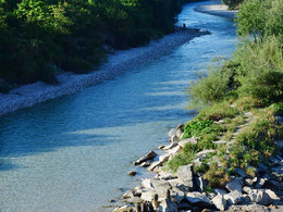
Almsee lake
Past the mouth of the Almsee, you walk along the eastern shore, past the Viscope, where you can enjoy a great and informative panoramic view, to the parking lot at the Seehaus. Continue a little further to the Echoplatzerl, above which you will find the new hanging chairs where you can enjoy the view and the echo. The path is a little steep here and the gravel makes the ascent a little difficult!
Please only use the designated parking spaces at the access points and show consideration for private property! Thank you for your fairness! The deviations in the kilometers and times are due to the access from the parking lots to the trail or to the rest areas.
Paths covering:
further information:
- culinary interesting
- Multi-day tour
- Possible accommodation
- Board possible
Details - hiking
- themed path


How to get to the Almtal (to Bad Wimsbach-Neydharting):
We recommend that you travel by public transport!
By train: to Wels station with IC trains on the Westbahn line (ÖBB and Westbahn) (line 101), then change to the regional trains in the direction of Attnang-Puchheim to Lambach station. Change to the "Vorchdorfer Bahn" from Stern & Hafferl (line 160) to Bad Wimsbach-Neydharting station.
To travel home from Grünau im Almtal, take the Almtalbahn (line 153) back to Wels station with a connection to the IC trains on the Westbahn line.
By bus:
OÖVV bus route 504 Wels - Lambach - Bad Wimsbach - Roitham
OÖVV bus route 533 Almsee - Grünau - Gmunden
Bus-train information
with the Salzkammergut Shuttle Service Route 80 from Bad Wimsbach station to Almspitz or for the journey home from Almsee to Grünau im Almtal station with the Salzkammergut Shuttle Service 60.
For both routes, call the cab center at least 1 hour in advance on 050-422 422 and order.
Bike & Hike, arrival by bike:
Coming from Wels or Linz or from Passau via Vöcklabruck and Schwanenstadt auf the R 4 Traunradweg or R6 Römerradweg, coming to Lambach, via the Traunkraftwerk Lambach and to Bad Wimsbach-Neydharting in the direction of Vorchdorf Einsiedling .
There is also a cycle connection from Gmunden via Vorchdorf to Bad Wimsbach-Neydharting.
By car:
Highway A1 Westautobahn Exit 207 exit Vorchdorf at the traffic circle - direction Lambach to Bad Wimsbach-Neydharting, approx. 7 km
From Wels or Schwanenstadt on the B1 federal highway to Lambach - to Stadl Paura, then in the direction of Vorchdorf to Bad Wimsbach-Neydharting
From Gmunden on the B144 via Roitham to Bad Wimsbach-Neydharting
Please only use the designated parking spaces at the entry points and show consideration for private property! Thank you for your fairness!
- Suitable for groups
- Suitable for schools
- Suitable for single travelers
- Suitable for families
- Suitable for friends
- Suitable for couples
- Suitable for children
- Spring
- Summer
- Autumn
Please get in touch for more information.
Im Dorf 17
4645 Grünau im Almtal
Phone +43 7616 8268
Fax machine +43 7616 8898
E-Mail almtal@traunsee-almtal.at
Web www.traunsee-almtal.at
Web www.genuss-am-almfluss.at
http://www.genuss-am-almfluss.at
You can also visit us on
FacebookVis-à-vis users
1. The tours presented for hiking, walking, biking and road biking, mountain biking, motorbiking, horseback riding, climbing, cross-country skiing, and going on skiing and snowshoe tours etc. are to be considered non-paid tour recommendations and only serve as non-binding information. We have no intention of concluding a contract with the users of this website. The utilisation of the data does not lead to the establishment of a contract with us.
The data may only be used for private use; any commercial use is prohibited. In particular, it is not permissible to offer the data on commercially run websites, file-sharing platforms etc. or to use it to develop commercial products. Downloading data does not imply that users are granted rights to the data concerned.
The tour recommendations posted were created with utmost care; nevertheless, we assume no liability for the correctness and completeness of the information.
We point out that neither the tour recommendations included on this website nor the associated data and information were posted by us, but rather by third parties (Art. 16 Austrian E-Commerce Act). We have no influence on whether the details provided (e.g. distance, level of difficulty, change in altitude, description etc.) are authentic, correct and complete. We do not review these third-party contents. For this reason, we assume no liability for the authenticity, correctness and completeness of the information.
Construction-related measures or other influences (e.g. landslides and similar occurrences) can lead to temporary or permanent changes in a route (e.g. loss of a bridge and similar occurrences). Such occurrences can lead to part of the route or the entire route becoming impassable.
The use of the data as well as undertaking (riding, walking, taking etc.) the recommended tours or using the network of paths occurs at users’ own risk and on their authority. In particular, users themselves are responsible for the choice of route, outdoor orientation, adherence to traffic rules, supplies and equipment for tours listed in Point 1 (e.g. bicycle etc.), wearing a helmet, estimating their own fitness, recognising dangers and maintaining an appropriate velocity. We exclude ourselves from any liability whatsoever for damages, in particular accidents, that occur whilst taking part in the recommended tours.
2.Some of the tours lead over roads with normal traffic conditions. Please observe that there is an increased risk which can be avoided by means of appropriate attention and proper estimation and implementation of one’s own abilities. For this reason, please travel a route that is unfamiliar to you slowly and with special care. Pay constant attention to potential dangers and always observe traffic. Do not leave the routes featured in descriptions.
The potential use of private roads, in particular forestry roads and agricultural transport roads, can be subject to legal restrictions, which must be observed and adhered to.
The normal traffic rules apply. Each user (e.g. biker, motorbiker) is responsible for adhering to these rules and maintaining his/her bike/vehicle and its equipment (lights, brakes etc.) in good working order. Each user is also responsible for ensuring that he/she rides at a velocity that is appropriate for the conditions and his/her skill level and for maintaining sufficient distance to the rider in front. We explicitly recommend adjusting velocity to correspond to the respective field of vision, wearing a helmet, using reflective clothing (or similar) and employing bicycle lights in line with regulations.
3.Each tour requires good physical fitness as well as detailed planning. We explicitly recommend only taking the tours in the case of optimal healthiness.
We recommend that you conclude an accident and liability insurance policy. Use an onboard computer that displays the respective kilometres travelled per day and is calibrated for the front wheel.
4.Special for mountain bikers – Fair-play rules:
Mountain biking is one of the most wonderful outdoor leisure-time activities. Whilst biking or on a mountain biking tour, mountains and lakes, meadows and cabins are re-discovered in new ways. A couple of rules for fair play in the forest help to avoid conflicts whilst mountain biking.
a.Pedestrians have the right of way: We are accommodating and friendly to pedestrians and hikers. Upon encountering these fellow travellers, we alert them by using the bicycle bell and slowly overtake them. We avoid paths with heavy pedestrian traffic altogether. Take nature into account: We do not leave refuse behind.
b.The braking distance should be half of the total distance visible: We ride at a controlled pace, are ready to brake and maintain a braking distance half as long as the total distance visible, especially in curves, because we always have to count on obstacles on the path. Damage to the path, stones, branches, wood piles, grazing livestock, cattle grids, barriers, tractor-type forestry machines and authorised vehicles pose dangers that we need to be ready for.
c.Don’t drink and drive!: Do not drink alcohol when mountain biking. Take care at stop-off points (dealing with bike racks, dirty shoes or clothing).
It is obligatory to provide first aid!
d.Marked routes, closed paths and blockades: Keep to the marked routes, observe the blockades and accept that these roads are primarily for agricultural and forestry use!
Blockades can often not be avoided and are in your own interest. Biking beyond the intended path and outside of opening times is punishable and turns us into illegal bikers.
e.We are guests in the forest and behave accordingly, including vis-à-vis forestry and hunting staff. Whilst mountain biking, mobile telephones and music players are forbidden! Biking requires your full attention.
f.Avoid unnecessary noise. Out of consideration to the animals living in the wild, we only bike during full daylight. As a principle, we always wear our helmet (even when riding uphill)! Don’t forget emergency supplies: We always have a repair set and bandages along.
g.Don’t overestimate your skills: We should not overdo it when it comes to biking technique and physical fitness. Take the level of difficulty posed by the route into consideration and make a precise estimate of your experience and skills as a biker (braking, bell, lights)!
h.Close gates: We approach grazing livestock at a walking pace and close every gate behind us. We should avoid causing escape and panic reactions in the animals. Nothing stands in the way of the fun and athletic challenge in the mountains and forests!
i.Traffic rules: The general traffic rules (StVO) apply for all the mountain biking routes and we adhere to them. Our bike therefore needs to be in perfect technical condition and equipped in line with the traffic rules, including brakes, a bell and lights. We inspect and service our mountain bikes regularly anyway.
5.We assume no liability for the contents of external websites; in particular, we assume no liability for their statements and contents. Moreover, we have no influence on the design or contents of the websites to which hyperlinks on traunsee.salzkammergut.at lead or from which hyperlinks lead to traunsee.salzkammergut.at. There is no on-going review of websites to which hyperlinks on traunsee.salzkammergut.at lead or from which hyperlinks lead to traunsee.salzkammergut.at. We do not appropriate the contents of websites to which hyperlinks on traunsee.salzkammergut.at lead or from which hyperlinks lead to traunsee.salzkammergut.at.
Vis-à-vis bloggers
PLEASE OBSERVE:
1. Each of your tour recommendations for hiking, walking, biking and road biking, mountain biking, motorbiking, horseback riding, climbing, cross-country skiing, and going on skiing and snowshoe tours etc., along with other details and information, is free of charge. In particular regarding the correctness of the information, we assume no liability, nor do we assume any liability whatsoever for the consequences of the use of your tour recommendation by a third party (in particular by a user of this website). We do not review the tour recommendations you post, including other details and information, at any time.
We have no intention of concluding a contract with persons who post tour recommendations and/or other details and information on this website. Posting data (information) does not imply that a contract has been concluded.
By recommending a tour, we assume special responsibility vis-à-vis other athletes. Please take this responsibility seriously and describe your tour recommendation with utmost care and to the best of your knowledge and belief.
2.Your tour recommendations must therefore clearly and unambiguously include at least the following criteria and provide a sufficiently detailed description:
• Starting point
• Detailed route description
• Distance/Overall distance
• Level of difficulty
• Dangerous spots
• Average duration of trip
• Change in altitude
• Finishing point.
If possible, please provide the change in altitude.
3.When you post a tour recommendation, you give us the order to save your tour recommendation and/or the details you provide on our website and to make it/them accessible to third parties, in particular to users of this website, in the long term. We reserve the right to block or delete tour recommendations and/or other details and/or information that you post, either partially or entirely, at any time without providing a justification. Should this occur, it grants you no rights whatsoever.
Thank you for your efforts!
4. We are not responsible for the contents of external websites; in particular, we do not assume any liability for their statements or contents. Furthermore, we do not influence the design or contents of websites that can be accessed from traunsee.salzkammergut.at via hyperlinks or that use hyperlinks to refer to traunsee.salzkammergut.at. The websites that can be accessed from traunsee.salzkammergut.at via hyperlinks or that use hyperlinks to refer to traunsee.salzkammergut.at are not regularly monitored. Furthermore, we do not assume any claims to the websites that can be accessed from traunsee.salzkammergut.at via hyperlinks or that use hyperlinks to refer to traunsee.salzkammergut.at.